Showing posts with label Peloponnesiaca. Show all posts

Friday, October 28, 2016

Wool and Rubble Walls: Domestic Archaeology in the Medieval Peloponnese

Back in March 26, 2015, I participated in a conference on Byzantine textiles at Dumbarton Oaks, "Liminal Fabrics: Furnishing Textiles in Byzantium and Early Islam." I made the argument that piles of rubble walls and ceramics from archaeological survey tell a much better story about medieval textiles (through production) than the few surviving pieces in museum collections (through artistic analysis). 


I have just finished writing up the essay and submitted it for review in the conference publication, edited by Gudrun Bühl, director of the Dumbarton Oaks Museum. I celebrate International Open Access Week by posting my draft.


This is the first paper that I have written entirely on iCloud's Pages, integrating laptop, tablet, and smart phone in one process. The paper was never printed out in hard copy or read as a Word document.

Tuesday, October 11, 2016

Doxiadis: The Archaeology of WWII Destruction

We have started working on the book manuscript for the deserted village of Aigition/Strouza. This is the site that we have been surveying for the last four years, a village founded around 1850, with many houses built with remittances from the U.S. in the 1910, burned by the Germans in 1943 (its population taken into a concentration camp in Athens), reoccupied and abandoned slowly.

There is very little archaeological work on one of the most important phenomena in the Greek countryside, the burning of 1/4 of all standing Greek villages during World War II (according to the Nuremberg Trials: 1,600 out of 6,500). With all attention place on reconstruction and the scars of the Civil War, this is an archaeological chapter that has staid closed in Greece. One of the important figures in the documentation of destruction was Constantine Doxiadis, director of urban planning in Athens in 1937, and director of the reconstruction. Doxiadis is best known for his ekistics movement and his planning of major cities like Islamabad or, closer to my home, Philadelphia's Eastwick neighborhood.

One of the lesser known activities of Doxiadis are his documentation of villages. During the war, he served in the resistance and published the only underground architectural journal of occupied Greece. After the war, he became director of the Ministry of Housing and Reconstruction, where he sent out architects throughout Greece to collect data on villages and architecture. This led to the publication of a series of pamphlets in English as "Series of Publications from the Undersecratary's Office for Reconstruction" in 1947. These publications coincide with Doxiadis' role as Greek representative at the United Nations International Conference of Housing, Planning and Reconstruction in San Francisco, etc. Reconstruction in Greece, of course, got wrapped up in the Marshall Plan and the Cold War, which gets us into tricky geopolitical waters.

In a 2010 conference "Front to Rear: Architecture during World War II" held at the IFA, Ioanna Theocharopoulou, urged us to reconsider "Constantinos A. Doxiadis: The War and the Archive," (watch the paper here). I love Theocharopoulou's thesis and I have followed up the publications. I would love to visit the Doxiadis archive in Athens in some future point. 

Destruction of Towns and Villages in Greece (Series of Publications from the Undersecratary's Office for Reconstruction No. 11, Athens: 1947) contains invaluable raw data, such as a location map of all destroyed villages, and detailed destruction maps for Attica, Piraeus, Chania, Kalavryta, Larissa, and the Corinth canal. These are ready to be georeferenced in GIS and taken into the field, so that we can initiate a systematic archaeology of crisis. The first thing I'd like to do is tackle Kalavryta, the best known of massacres (after perhaps Distomon).

I am working on an article with a wonderful team of collaborators on locating the refugee settlement of Washingtonia, founded in 1829 by Samuel Gridley Howe. David Pettergrew has published a post on the liberation of Corinth and I have promised to send him Doxiadis' map of the location spots of all the damage on the Corinth canal. He tells me that he already has other reports, and I'm curious if they two are consistent.

Below, I post the map of Kalavryta, in case anyone wants to get a GIS head-start.


Monday, September 26, 2016

Finding Washingtonia


I have been enjoying the digital conversation following my post on Washingtonia, the first refugee camp in Greece, built by Samuel Howe (shown here, about 30 years after his youthful work in Corinth)

I have this crazy idea that if I digitally pool the ground expertise of Tim Gregory, Guy Sanders, Tom Galant, Bill Caraher, Dave Pettegrew, Richard Rothaus, Hector Williams, Dimitri Nakassis, and James Herbst, we will locate the site of Washingtonia remotely. Toward this digital conversation, I transcribe two documentary details (which Tom has in his file cabinet back in San Diego and not in Athens) from Franklin B. Sanborn (journalist, friend of Emerson, member of the Secret Six) and Laura H. Richards (Howe's daughter). 

The first document was found by Sanborn in the letters between Howe and Horace Mann, and quoted Howe directly:

"Afterwards I applied to the Government, and obtained a large tract of land upon the Isthmus of Corinth, where I founded a colony of exiles. We put up cottages, procured seed, cattle, and tools, and the foundations of a flourishing village were laid. Capo d’Istria had encouraged me in the plan of the colony, and made some promises of help. The Government granted ten thousand stremmata of land to be free from taxes for five years: but they could not give much practical help. I was obliged to do everything, and had only the supplies sent out by the American committees to aid me. The colonists, however, cooperated, and everything went finely. We got cattle and tools, ploughed and prepared the earth, got up a school-house and a church. Everything went on finely, and we extended our domain over to the neighboring port of Cenchraea, where we had cultivated ground and a harbor. This was perhaps the happiest part of my life. I was alone among the colonists, who were all Greeks. They knew I wanted to help them, and they let me have my own way. I had one civilized companion for awhile, David Urquhard, the eccentric Englishman, afterwards M. P. and pamphleteer. I had to journey much to and from Corinth, Napoli, etc. always on horseback, or in boat, and often by night. It was a time and place where law was not; and sometimes we had to defend ourselves against armed and desperate stragglers from the bands of solider now breaking up. We had many ‘scrimmages,’ and I had several narrow escapes with life. In one affair Urquhart showed extraordinary pluck and courage, actually disarming and taking prisoner two robbers, and marching them before him into the village. I labored here day and night, in season and out, and was governor, legislator, clerk, constable, and everything but patriarch; for, though I was young, I took to no maiden, nor ever thought about womankind but once. The Government (or rather, Capo d’Istria, the President) treated the matter liberally—for a Greek—and did what he could to help me." (Sanborn 1891, p. 79-80; Howe 1906, vol. 1, p. 365-366)

The second document is not in Howe's words. Sanborn summarizes some topographical information based on the correspondence between Howe and Kapodistrias, which he saw in 1870.

"I found at Athens, in 1870, the correspondence between Capo d’Istria and Dr. Howe on this subject printed in the great volumes of the unfortunate President’s correspondence which his brother edited long afterwards. The colony was near the present railway station of Hexamilia, on the way from the new town of Corinth to Argos. It extended southeast from Hexamilia towards Cenchraea, and was nearer to the Isthmian sanctuary than to New Corinth, which was only founded in 1858. Old Corinth lay on the northwest side of Acro-Corinth, from Dr. Howe’s village." 
(Sanborn 1891, p. 79-80; Howe 1906, vol. 1, p. 365-366)

So, if we were to search for the site of Washingtonia, we need to start from the Hexamilia train station. My sense is that the houses of this camp were huts made out of wood. But knowing that a church and a school house were also built increases the chances of visible masonry remains above ground. I zoom into Google Maps and find myself at 37°53'57.16"N , 22°54'28.45"E where the railroad crosses the main street. The area is industrial. Here I leave my Corinthian topographers to take over.


These sources reveal a couple of additional characters in the story. First is the Scottish politician David Urquhart who assisted Howe in the operations of the camp (there might be some further clues in his papers at Baillol College). Second is an unnamed local woman with whom Howe had a relationship. I am reading the new biography of Howe's wife, by Elaine Showalter, where I learned about the relationship with the Corinthian woman. "Although he was repelled by the Greek tribal women, whom he found coarse, illiterate, and ugly (moreover, he wrote primly, they did not wear stays [corsets]), Howe probably had his first sexual experiences in Greece. He occasionally admitted in his journal that he had been aroused by seeing the body of a young camp follower, “ a most elegant young creature,” and even confessed to getting involved with a woman while he was doing relief work in Corinth, although the Greek government, unsurprisingly, ‘treated the matter liberally.” (Showalter 2016, p. 29).

REFERENCES

Howe, Samuel Gridley. 1906. Letters and Journals of Samuel Gridley Howe, ed. Laura E. Richards, Boston: Dana Estes and Company.

Sanborn, Franklin. 1891. Dr. S. G. Howe: The Philanthropist, New York: Funk and Wagnalls.

Showalter, Elaine. 2016. The Civil Wars of Julia Ward Howe: A Biography, New York: Simon Schuster.

Monday, September 19, 2016

Washingtonia


During this last year, I have been energized by the conversations over archaeological responses to the recent refugee and migrant camps in Greece. There is a rich tradition of an archaeological discipline, from Janet Okely's Roma camps in England (1975) to Jason De León s Undocumented Migration Project  in the Arizona-Mexico desert (2009). The conversation in Greece began in April, with the Archaeological Dialogues plenary session in Lesvos (see, The Nation). It will continue at the American Anthropological Association meetings in Minneapolis this November with two panels devoted to the Contemporary Archaeologies of Forced and Undocumented Migration as well as in January at the annual meetings of the Society of Historical Archaeology at Fort Worth. 

Struggling to organize my own thoughts and practices around this topic has resulted into a number of ideas. One of them, has been the realization that we need to do a lot more fieldwork-based archaeology (as opposed to the theoretical-based archaeology that also needs to be done in tandem). 

Few countries have the quantity of refugee settlements that Greece has historically had. Anthoula Karamouzi (1999) drafted a catalog of refugee sites in Greece and it numbers to the 3,000s. We tend to think of the Asia Minor refugees because of their demographic impact (2,089 new villages built by the Refugee Resettlement Commission) but we forget the refugees of earlier centuries like the encampment of African slaves under the Acropolis in the 18th century. In spite of the great quantity of refugee sites in the history of Greece, few of them have been approached archaeologically (as far as I know). I would argue that in order to build a hefty archaeology of the contemporary crisis, we also need to work on the foundations of historical crises.

So, I ask myself this question. What is the one refugee camp of historical significance that I would excavate first. This last summer, I had a wonderful conversation with Thomas Gallant to discuss our two projects on deserted villages (his in Kefalonia and Andros; mine in Lidoriki). The conversation also centered around the 1897 Greek-Turkish war and its archaeology. Tom has argued in his Edinburgh History of the Greeks 1768-1913 and elsewhere that we need consider the 1893 Greek bankruptcy and the 1897 failed war with Turkey as watershed moments in modern history. Tom has called for a carefully study of the 1897 battle lines in Thessaly.

In this thrilling conversation (over delicious fresh fish and wine in Pangrati), we started talking about the site of Washingtonia, in the Corinthia, as another ideal place to excavate. And this brings me back to the question of refugee sites. The first documented refugee site in Greece was built by the American activist Samuel Gridley Howe in 1829 at modern day Hexamilia. He named it Washingtonia. In his letters, we have a clear and detailed description of the architectural character of this site. During the 1990s, Timothy E. Gregory surveyed the area during the Eastern Korinthia Archaeological Survey, finding no overground elements (see discussion here). Guy Sanders, director of the Ancient Corinth Excavations has also explored the site (see discussion here). Between Gallant, Gregory, Sanders, as well as Lita Gregory, Bill Caraher, David Pettergrew, and Dimitri Nakassis, I am sure the boundaries of a trench would easily emerge.

Howe described Washingtonia in his letters (edited posthumously by his daughter). The description provides clear parameters of what this excavation should look for. Definitely not traditional masonry walls, but obviously the shadows of ephemeral architecture, huts made of wood.

"I selected twenty-six families from Sico, Aivali, and Athens brought the men herewith me, in a few days put up some huts, and then transported their families here. They were all then employed in cultivating the earth. I procured about two hundred of the poor who were wandering about Corinth in idleness, and began building huts for the colonists. I determined to give each family a house, or hut as you would call it and as the foundations and the fallen walls [of a former village] remained, and since the earth mixed with water makes mortar, there was little that could not be done by the poor. They make the mortar, ring the stones, cut and bring the wood, and are paid [p. 354] merely as much bread as they can live up… When I say ‘doors,’ however, you must not imagine panels, hinges, latches,, locks, etc. There is not a particle of iron about them except nails, and perhaps I cannot give you a more correct idea of the economy and even saving we use than by describing one of them. It is composed of three boards, six feet in length, nailed together, and having an upright stanchion attached. Each end of this stanchion is pointed, and it is set into a hole mortised in the door-frame above and below. This serves for hinge. This door stands open in summer, and when closed is fastened by a wooden bar which shoves into a hole in the wall by its side. [p. 355]"

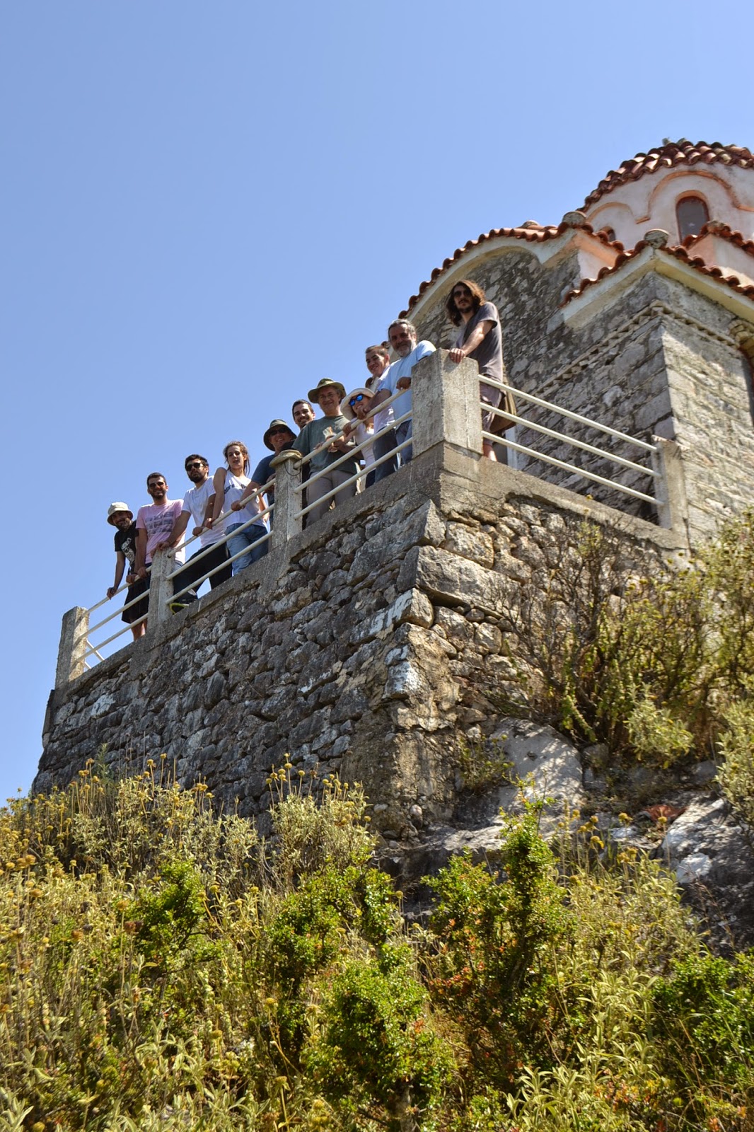
In 2015, Todd Brenningmeyer and I had the pleasure of surveying the deserted village of Penteskouphi with James Herbst and a gropu of wonderful undergraduate students from F&M and Maryville (picture above). Sanders presented his ongoing analysis of this mud-brick village at the Deserted Village panel of the Archaeological Institute of American 2016 meetings in San Francicso. While presenting this survey at a conference on the Ludlow Massacre at San Francisco State, I had the most amazing experience. A gentleman in the audience came to me after my talk and told me that his father was assassinated during the Greek Civil War. His father was abducted from Hexamilia (the site of Washingtonia), killed, and the body was dumped in Penteskouphi, but has never been found. Could the work in Penteskouphi be integrated with Hexamilia? 

Over the summer, I have been doing more research on the archaeology of Greek immigration. In the 1820s, Greek Philhellenism was centered in Boston (e.g. Howe) and Philadelphia. What I only recently discovered was that Howe went to Brown University in Rhode Island (where Yannis Hamilakis is now teaching). Brown's flagpole is dedicated to Howe and most amazingly, it was paid by the American Hellenic. The base of the flagpole has the shape of a Doric capital (see here). Also note that there is a brand new biography of Julia Howe (Samuel's wife) by Elaine Showalter that should nicely complement the 2012 Howe biography by James Trent. Howe's Papers are not at Brown, unfortunately, but at Harvard.

BIBLIOGRAPHY

Gallant, Thomas. 2015. The Edinburgh History of the Greeks, 1768 to 1913: The Long Nineteenth Century, Edingurgh: Edinburgh University

Gregory, Timothy E. 2007. “Contrasting Impressions of Land Use in Early Modern Greece: The Eastern Corinthia and Kythera,” in Between Venice and Istanbul: Colonial Landscapes in Early Modern Greece (Hesperia Supplements 40), ed. Syriol Davies and Jack Davis, pp. 173-198, Princeton: American School of Classical Studies at Athens.

Howe, Samuel Gridley. 1906. Letters and Journals of Samuel Gridley Howe: The Greek Revolution, ed. Laura E. Richards, Boston: Dunn, Estes, and Co.

Sanders, Guy D. R. 2013. “Landlords and Tenants: Sharecroppers and Subsistence Farming in Corinthian Historical Context,” in Corinth in Contrast: Studies in Inequality, ed. Steven J. Friesen, Sarah James, Daniel Schowalter, pp. 103-125, Leiden: Brill

Showalter, Elaine. 2016. The Civil Wars of Julia Ward Howe: A Biography, New York: Simon Schuster.

Trent, James W., Jr. 2012. The Manliest Man: Samuel G. Howe and the Contours of Nineteenth-Century American Reform, Amherst: University of Massachusetts Press

Friday, February 05, 2016

Karkavitsas: HIS FLUTE

Andreas Karkavitsas, “Η Φλογέρα του,” [“His Flute”], in Διηγήματα [Short Stories], Athens: Estia (1892), reprinted in Άπαντα, ed. Georgios Valetas, vol. 1, pp. 133-155. There is a digital (but slightly different) version of the text here.
---------------------

"His Flute" is the story of a newlywed Stathis and Smalto. Secretly, Smalto is thrown into disarray by her inability to resist a repulsive shepherd who seduces her by his flute-playing. Smalto's inner voice that tells the story struggles ethics of aesthetics. The affair is put to rest only when Smalto shatters the instrument of seduction. "The flute was small and golden with five black holes in its mouth and one more on the opposite side." Ήτο τω όντι η φλογέρα του Μήτρου. μικρά, χρυσίζουσα, με πέντε τρύπας μαύρας εις τα χείλη και άλλην μίαν εις το αντίθετον μέρος.

Seduction takes place in the fields where Smalto herds her ducks and the shepherd Mit herds his sheep. But the village plays an important role with its “numerous houses scattered here and there along a low hill.” At first, the houses resonate with life in celebration of its patron Saint Nicholas. But when the festival is over, and the workdays begin, the village is abandoned by its inhabitants working in the fields. “All the doors were shut and through the small windows one could see the darkness and abandonment inside.” οι ευάριθμοι οικίσκοι του, εδώ κι εκεί επί χαμηλής λοφοσειράς σκορπισμένοι, είχον τας θύρας όλας κλειστάς και από τα μικρά παράθυρα των εφαίνετο εντός το σκότος και η ερημία. [134] This is a helpful insight to consider. A Greek village would have been entirely empty for most of the day. Men, women, and children would be out in the fields.

In this silence, only the Melopoulos house stands out. Its newlywed bride Smalto is still inside. She refuses to go to work, to leave the village because she wants to avoid the shepherd’s temptation. Looking voyeuristically from the outside, the readier, captures this view. “The light of day entered already in abundance through the open door and window, from which Smalto was seen in the shadow with still sleepy eyes. With a heavy body, she turned the bedspreads one-by-one from the ground over a turned-over basket." Το φως της ημέρας εισέδυεν ήδη άφθονον από της ανοικτής θύρας και του παραθύρου, από του οποίου εφαίνετο η Σμάλτω εν τη σκιά με νυσταλέους ακόμη οφθαλμούς και βεβαρημένον το σώμα, εγείρουσα νωθρώς τας στρωμνάς μίαν – μίαν από του εδάφους και αποθέτουσα επί μιάς ανεστραμμένης κοφίνας. [134]

Karkavitsas uses architectural detail to articulate states of mind. And Smalto is not an ordinary villager. First, she is of Vlach descent -- like the shepherd. Second, and more importantly, she is a transparent medium of sensational experience. Her optic centering turns those experiences to fire. "She was a perfect mirror of a wild existence. Her person was extremely curious of sensing natural phenomena. She collected experiences and centered them within her as a lens centers the ray of light." Ήτο δε τέλειος καθρέπτης μιάς αγροδιαίτου υπάρξεως. Το άτομόν της ήτο υπερβολικώς περίεργον εις τας εντυπώσεις της φύσεως και τα υπέμενε και τας συνεκέντρου εντός της όλας, όπως ο φακός τας ηλιακάς ακτίνας. [137]

Then there is a wonderful description of the landscape, when Smalto goes out into the fields (too long to translate right now)

Ο ήλιος είχεν υψωθή αρκετά εις τον ορίζοντα, κολυμβών μέσω αργυρού αιθέρος πυκνοτάτου και περιέλουε τους θερισμένους αγρούς, τας πρασίνας σταφιδαμπέλους, τους βυσσινίζοντας βουνούς του Χελωνάτα και τα πέριξ όλα δι’ αφθόνου φωτός . τα χωρία κατέκειντο εδώ κι εκεί , με τας υπομαύρους στέγας και τους λευκοκιτρίνους τοίχους των οικίσκων των, εν αμόρφη όγκω, ως χορταριασμένα ερείπια. Ποίμνια έβοσκον παντού και βοών αγέλαι και ίππων εν συμβιώσει, ενώ ωρθούντο πλησίον αι σκιάδες των φυλάκων, με την [138] πιμήκη εκ ξηρών χόρτων στέγην και τους λεπτούς και στεβλούς στύλους των, ως μεγάλα καψαλά πτηνά, ορθούμενα επί των κατίσχνων ποδών των. Από πολλα μέρη ανέβαινον λευκοί καπνοί, ταχέως εξαφανιζόμενοι, και υπεφαίνοντο κάποτε γλώσσαι φλογών, ενώ αντήχει ο τριγμός του ξηρού χόρτου, καιομένου επί των αλωνίων. Τα βουνά προς ανατολάς εκρύπτοντο μέσω πυκνής ομίχλης και μόνον τ’ ακροβούνια ασθενώςν διεγράφοντο εις τον ορίζοντα, ως κομμένα χάρτινα συμμπλέγματα όπισθεν γαλανής υάλου. Κι εν τη νεκρική εκείνη της πεδιάδος ησυχία μόνον τα ξηρά χόρτα και τα φύλλα εψιθύριζον κινούμενα υπό του ανέμου, όστις έπνεεν από της θαλάσσης δροσερός – δροσερός. [139]

Smalto abandons herself in this landscape. Lying on the ground, her hands immersed into the clots of dirt, she shakes from the weight of her own body, as the muscles slowly relax. Karkavitsas' description is so somatic. Η χείρ της λυγερής επόνει τρυπωμένη επί των βώλων του χώματος κι έτρμεεν ελαφρώς απηυδηκυία υπό το βάρος του σώματος, χαλαρουμένου ολονέν. [140]

One of my favorite things about the story is also how Smalto herds her ducks, with the words Πίκιο, πίκο. το γαλί, γαλί, γαλιό [144]


A few words about location. Karkavitsas tells us that the story takes place in the village of Troumpé, which was renamed Demetra in 1953 (Location, 37°53'11.21"N, 21°13'16.01"E). The village is in the flat plains of Vartholomio and Gastouni. When Smalto goes herding, she seems to be heading east towards Kastro Chlemoutsi, where the terrain gets hillier and closer to the beautiful coast. The area presents an interesting topography (see Kourelis 2003, p. 254). Kastro Chlemoutis is the only landscape feature visible across the plain which it commands. Demetris Athanasoulis describes this area as the triangle of power in the Frankish Middle Ages (see Athanasoulis 2013). It has unique landscape sensibilities. I vividly remember stoping at Karkavitsas' village nearby and having a coffee with Demetris. The kafeneion was in the main street thoroughfare. It was such a unique feeling.

Another interesting location is referred to briefly, when the shepherd Metros narrates his story to Smalto. He is an outsider, an orphan, herding other's sheep for a living. His point of origin is from the lagoons around Kotychi, a different ecology altogether (a series of lagoons used for fishing but surrounded by forest). Μίαν ημέραν ο Μήτρος διηγήθη την ζωήν του, με δύο λόγια. Κατήγετο από τους Κατσαπαίους, οικογένειαν βλαχοποιμένων, κατασκηνούσαν πλησίον του ιχθυοτροφείου του Κοτυχιού. Οι γονείς του αφήκαν αυτόν ορφανόν πολύ μικρόν, εις την νάκαν ακόμη. ο πατήρ του απέθανον από τύφον, πριν γεννηθή αυτός. η μήτηρ του αμέσως μετά την γέννησίν του. ... κι εμισθώθη εις ένα κτηνοτρόφον εκ Σουλεϊμάναγα, του οποίου τώρα έβοσκε τα πρόβατα. [143]

Sunday, November 16, 2014

Deserted Greek Villages: Hackman Research Fellowship Report

This summer, I received a Hackman Research Fellowship grant from Franklin and Marshall College, which paid for my air-fare and car-rental in Greece. What follows is my report submitted to the Committee on Grants. The report offers a nice opportunity to enumerate the various activities of the two-week research and to thank Lucille and William Hackman for their support of over 55 collaborations between faculty and undergraduate students.

During my Hackman Research Fellowship (June 2014), I initiated a new project on the architecture and archaeology of abandoned 19th-century villages in Greece. Joel Naiman ('15) accompanied me on a Hackman Student Fellowship for the duration of the project, and Joanna Radov ('16) joined us for part of the project on a Summer Research Fellowship. The objective of the project was to design a long-term research methodology, while also collecting as much data as possible for a short-term publication. Radov (an Anthropology major) had completed an Independent Study on the sociology of Greek villages the previous semester, and Naiman pursued an Independent Study on historic preservation the following (current) semester. After our return from Greece, Naiman processed the data from one case-study, on the Parhhasian Cultural Heritage Park. He presented a poster "Preserving Greece’s Past: Managing the Architectural Heritage of an Arcadian Village" at the Fall Research Fair and in early-December we will coauthor a formal report to be included in the annual research publication of the Park. In Spring 2016, we hope to submit an article for review in Building and Landscapes, the national journal of the Vernacular Architecture Forum. Naiman’s experiences in Greece are informing his plans to enroll in a Master’s of Science program in Historic Preservation with a future interest in cultural heritage law.

Overshadowed by neighboring temples of antiquity, the medieval and early modern villages of Greece are its most neglected archaeological heritage. Returning to fieldwork that I conducted for my PhD thesis, I revisit the archaeology of deserted villages. Much has changed since the pioneering University of Minnesota Morea Project, my introduction to vernacular architectures studies in the 1990s, where 150 Greek villages and over 3,000 houses were surveyed. Having inherited the archive of this decade-long collaborative project, I revisit the architectural data that was partially published in Houses of the Morea: Vernacular Architecture in the Northwestern Peloponnesos (1205-1950) and the villages themselves. In order to collect new data on villages, we collaborate with ongoing archaeological projects that have already established research centers in Greece. Archaeology in Greece is strictly regulated by the Ministry of Culture, which awards only three excavation and five survey permits to American scholars. Without the financial resources or infrastructure to request one of these coveted permits, we chose to collaborate with projects that have already been granted such permits. Over the course of two weeks, we visited five ongoing archaeological projects that hosted us for 1-5 days. The projects were the Athenian Agora Excavations, the Mount Lykaion Excavations and Parrhasian Cultural Heritage Park, the Eastern Argolid Archaeological Project, the Ancient Corinth Excavations and the Lidoriki Project.

At each of these sites, we collected new data on domestic architecture. This scheme fulfills two simultaneous objectives; it contributes scholarly insights to each project's unique publication agenda, while it also creates a synthetic study among all the projects collectively. Given the increasingly limited resources, this collaborative approach seems fundamental. The pooling of resources and expertise allowed us to innovate in the field of digital humanities. Flying a drone over a number of villages, we created a new and efficient methodology to map villages and reconstruct them in 3D. The drone was brought by our collaborator Todd Brenningmeyer, professor of Art History at Maryville University. At the end of our fieldwork, we participated in a workshop at the Polytechnic Institute of Athens, among a group of digital archaeologists who are experimenting with drones, balloons, and photogrammetry at other sites. The audience of Greek students and academics underscored the vitality of digital mapping. This cutting-edge technology puts our work at new pedagogical thresholds at F&M, too. Having tested it in Greece, we are drafting a set of procedures that could be applied to future case studies in Lancaster County or other regions. Building on our experiences this summer, we are creating a digital mapping lab at F&M's Innovation Zone. A dedicated computer with mapping and photogrammetric software (Agisoft, QGIS) has just been installed (November 2014) and is connected with the 3D printer. In the next year, we hope to fundraise for the purchase of a drone to be used by the faculty widely.

For the remainder of the report, I will describe the specific activities that we carried out in each of the six sites.

1. Athenian Agora Excavations. The American School of Classical Studies at Athens has been excavating the ancient Agora since 1932. In order to reveal the coveted ancient layers buried below the modern city, the American School has had to demolish an entire historical neighborhood consisting of 18th- and 19th-century houses. Before demolition, the excavators produced a detailed photographic record of the house exteriors. Using 3D visualizing software, it is theoretically possible to rebuild those traditional houses in a digital environment. We spent one day at the archives of the Athenian Agora trying out this possibility in a single residential block that contained 12 properties. We combined data from the excavation notebooks, the architectural drawings, and the black-and-white photographs and assembled all the available 2D data (ground plans and facade elevations). We did not want to waste valuable fieldwork time in the digital reconstruction, so we left the processing for a future date. The Athenian Agora Excavations is a research center that brings together American faculty and students. While at the project, we had the opportunity to interact with scholars in residence, including F&M Classics professor Ann Steiner, who had spent her sabbatical year at the Agora. Our project in the Agora was supervised by the archivist Sylvie DuMont, who has just completed a book manuscript on the houses that were torn down for the excavation. I was a reviewer for that manuscript and was encouraged by the publisher to work with DuMont in the publication process. If completed in time for the publication, our digital reconstruction of the residential block could be included in DuMont's images.

2. The Mount Lykaion Project and the Parrhasian Cultural Heritage Park. One of the chief American excavations in Greece during the last five years has been the excavations at Mount Lykaion, the mythical birthplace of Zeus. While focusing on the altar of Zeus and the athletic site as the epicenter of excavation, the Mount Lykaion project has proposed the creation of culturla heritage park that includes a large area surrounding the mountain. Contained in the park zone are a number of villages that have received little scholarly attention. A team from the University of Arizona hosted us for two days at Mount Lykaion. We photographed and drew houses from two 19th-century villages, Ano Karyes and Neda. I had visited Neda four years ago (with a 2010 Hackman Fellow) and had compiled a preliminary overview of the most important old houses. I had targeted one house to be surveyed this summer, only to discover that it had been demolished. Our 2010 photographs of the building are sadly the only record of that structure. At Mount Lykaion we were hosted by project director David G. Romano. We lived in the village of Ano Karyes along with a team of three architecture students from the University of Arizona. 

3. The Western Argolid Project. This summer was the first season of a new archaeological survey and a combined field school for the University of Toronto and the University of Colorado. The project is a pedestrian survey, which systematically collects surface pottery and models the chronological profiles of the agrarian landscape. The research area is concentrated around village Lyrkia and contains a variety of standing structures. Focused on refining the surface survey methodology for its first season, the project did not target standing architecture. We prospected the village of Lyrkia for a future work. More importantly, we prospected a peculiar domestic arrangement built on the cliffs of the surrounding mountain. Dating to the 18th or early-19th century, this rugged installation most likely served as refuge to brigands engaged in guerrilla warfare with the Ottoman feudal overlords who administered the fertile lands below. Hiking to this location and rock-climbing to the top was the hardest part of the fieldwork. We spent one day in the project. At the end of the day, we visited the town of Myloi, a railroad depot during the late 19th-century. Built by French engineers in the 1880s, the train station and warehouses of Myloi contain European architectural elements that -- we believe -- trickled down to the vernacular architecture of the period. Our day in the Argolid was directed by William R. Caraher and Demetris Nakassis. It coincided with the visit of Rebecca Seifried, a PhD candidate in Anthropology at the University of Illinois at Chicago, who is writing her thesis on the deserted villages of the Mani, a region in the southwest corner of the Peloponnesian peninsula. Her insights in computer mapping and digital methodologies were invaluable.

4. Ancient Corinth Excavations. The site of Ancient Corinth has been excavated by the American School of Classical Studies since 1896. Whereas the ancient city has been the primary target of excavations, the project has also been innovating in the field of post-classical studies. The village of Ancient Corinth was itself a late-medieval settlement, which became largely depopulated after a series of earthquakes. Project director Guy Sanders, and project architect James Herbst have been promoting the integrative study of ancient and modern structures. The village of Penteskouphi was slowly abandoned in the 20th century. Constructed out of stone and mud brick, a group of eight houses are slowly deteriorating. The village has been used to train archaeologists in site formation processes, or in illustrating how buildings deteriorate. We were given a tour of Penteskouphi abandoned villages, as well as other 19th-century houses that survive within the excavation site. We spent one day in Corinth and did not collect any data. We simply took stock of the houses and photographed. The village of Penteskouphi, however, will be the next village that we hope to survey in future seasons.
5. The Lidoriki Project. The first week of our fieldwork was spent in the Peloponnese, traveling to three current projects for one or two days. The second week of our fieldwork was spent entirely in central Greece at the municipality of Lidoriki, in the region of Phocis, not far from Ancient Delphi. During the past four years, I have served as co-director of the Lidoriki Project, a collaboration with two colleagues of differing expertise. Miltos Katsaros, professor of architecture in the Athens Polytechnic Institute, brings his students to survey the region's architecture. Todd Brenningmeyer, professor of art history at Maryville University, oversees the digital mapping. The first season of our collaboration coincided with my last Hackman scholar four years ago. Back in 2010, we brought kites and helium balloons to help us document the cultural landscape and extensive rural architecture. This year, we brought a drone that supplemented the kites. The objective of the project is to provide a complete regional picture of agrarian life in this mountainous region. This summer, we surveyed three sites, corresponding two three different chronological periods, ancient Fyskos, medieval Kallion, and early-modern Aigition. The surveying procedure involved placing large targets on the ground and surveying their coordinates. These targets are visible from the drone and can be discerned in the photographs. The drone flies for about 20 minutes over the study area and captures close to 1,000 images. The images are then run through a photogrammetry software, which combines the raster data with the coordinate data and produces a 3D model. These high resolution models can be combined with the measured drawings of individual walls that the Greek architecture students are carrying out with traditional methods (paper, pencil, measuring tape).

Most of our five days in Lidoriki were spent in surveying with the drone. We also had the opportunity to test a couple of related projects, on the diaspora and on folk arts. The mountainous villages of Lidoriki flourished in the late 19th century. An economic crisis (similar to the one experienced by Greece today) lead to a mass emigration to the United States in the 1900s. Interestingly enough, the bulk of the diaspora ended up in Milwaukee, Wisconsin, where they transferred their pastoral skills to the industrial stockyards. In the 1970s, the Greek government built a dam to collect water that would feed the booming city of Athens, 100 miles to the east. The artificial lake submerged villages and farmland and it disrupted traditional networks, further exacerbating the rate of abandonment. The deserted village of Aigition that we surveyed by drone must be correlated to this immigration to the U.S. Using the Ellis Island archives, we have begun to correlate individuals who left their villages and moved to America. During our fieldwork, we met an elderly Greek-American on his annual summer visit to Lidoriki from Milwaukee. This personal link, we hope, will bring forth further connections between Milwaukee's current Greek community and the deserted villages they once occupied.

Finally, we had the opportunity to witness two cultural events in Lidoriki, a concert of traditional chamber music and a festival of folk dancing. Both experiences brought to life the vacant old homes. On our last day, we were also given an inside tour of a folk arts archive and museum. Our collaborators Sofia Klosa and Nikos Lakafosis, who reside in the village full time, have been collecting old agricultural tools, textiles, and handicrafts. They have remodeled an old house to store this material heritage with the hope of one day opening a Folklore Museum. WE applied the same photogrammetric methodology we used on villages to produce 3D models of the museum artifacts. We only had a few hours with the collection and photographed one wool spindle. In the future, we hope to bring a group of art historians that can survey the whole collection and produce a virtual music with 3D-images of the objects. Lidoriiki's remoteness means that, even if it opens, the Folk Museum will not be visited by too many people. A complementing website will assure the dissemination of these crafted objects. Once we have a large set of 3D-modeled objects and 3D modeled architectural spaces, we will be able to digitally reposition those domestic arts back into their original context.

Monday, May 26, 2014

Mapping Greek Villages: Neda

I am returning to the villages of Greece, continuing with fieldwork on vernacular architecture. Earlier plans of reviving the Morea Project had been thwarted by the sad death of project director Fred Cooper. In 2010, I visited David Romano's Mount Lykaion Project to brainstorm ways of integrate our old data from the Morea Project with the new data from Parrhasian Heritage Park. The two projects geographically overlap. We prospected the village Neda as one of the villages to be connected with the new path system. Unfortunately, it was not one of the villages that the Morea Project mapped, so we don't have the benefit of archival data from the 1990s. On the Parrhasian Park, see here.

The broader agenda for the summer is to explore the Greek house through multiple case studies. We will reconstruct 19th-century houses torn down in Athens in the 1930s (but well recorded by the Agora excavations), we will survey the town of Lidoriki in Central Greece (part of the ongoing FandM Lidoriki), we will visit the first season of the Western Argolid Survey, and we will explore the digital archives of Ancient Corinth. I will be accompanied by my student Joel Naiman, who will be working on this material all summer as part of a Hackman Scholarship at F&M. 

Lots have changed since I last surveyed Greek villages. Maps are not secretly guarded by the Greek state as treasures of military security. The proliferation of satellite mapping by Bing or Google have made any attempt by nation-states to control information obsolete. But the availability of free and ample data can be misleading. One has the feeling that all is actually available, since village plans are discernible in those satellite images and the human cartographer is obsolete. Google and Bing maps create a challenge in our field methods. I have thought about how to incorporate them in the survey this summer. It seems to me that a blend of high and low tech skills is necessary. Bringing a satellite image into the field does not actually assist the brain in making decisions about urban or architectural value about what is important and what is not.

This summer, I will test the following method. Although we'll be bringing drones, kites, and high-tech visual instruments, I will be maintaining quality control through hand drawings. Before leaving for Greece, I have created simply hand-drawn maps based on what is visible on Google Earth. The process is time-consuming because it requires careful looking and keeping of measurements without any tool other than the eye. So, I've taken my iPad to my favorite cafe with an internet connection; I've signed onto Google Earth; and with an 11 x 24 in drawing pad, I have tried to produce a set of simple black-and-white plan showing visible structures. The process follows producing three different site-plans. 

Part I: NEIGHBORHOODS


The first drawing takes the outer-most zoom of the settlement and moving back-and-forth between "map" and "satellite" determines what Google considers to be the major streets and boundaries of the settlement. The limits of the settlement Google denotes in gray, and here I have translated them into steeples. This proves useful in dealing with large settlements (which Neda is not) in subdividing the total area in smaller units that can receive a numerical system. In Neda, for example, you can see a dozen zones. In larger villages (like Lidoriki) we have 50.

II. BUILDINGS


Google and Bing images have enough resolution that one can discern roofs and building shadows, enough so that one can discern structures. Sliding through and zooming in-and-out of the Google satellite image, one can start placing buildings on the map. I do this first with a pencil, so that I an erase mistakes. Once I am sure I have all the structures accounted for, I just darken them is. So, these will become the objects of study. With this drawing in hand, we will visit each building and collect specific information.

III. SPACE


The final pass involves zooming further into Google and extracting finer information about the buildings, including how they relate to one another, roof types, etc.

So this is what I have prepared before the field. In a couple of weeks, I will join the Parrhasian Heritage Part team and see if this system works. There I will reunite with Mark Davison (Park Services) and David Romano (now at Arizona), who were my hosts two years ago. Wish us luck. I look forward to revisiting the house shown above that is one of the black fields in my drawings. The limited information from Google makes believe, however, that the house has greatly collapsed since 2010. 

Labels

Blog Archive

Kostis Kourelis

Philadelphia, PA, United States